
Sunday, 29 August 2010
Jack Frost, but Fine!!
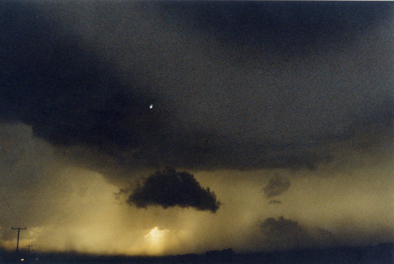
"TOP OF THE WORLD" The Pakistan Floods......

http://www.youtube.com/watch?v=JUMmUNWqM68
http://www.bbc.co.uk/news/world-south-asia-10981230
http://www.bbc.co.uk/news/science-enviroment-10958760
Friday, 27 August 2010
A "Fair" Bank Holiday Weekend!

Its the last British Getaway, dare I say it before Christmas and most folks just want to enjoy some late Summer warmth! This bank holiday will in all honesty be not that bad, no heatwave,though as winds will be in the NorthWest bringing along some showers and cloudier spells but the best of the sunshine will be found in the West of our region, so if youre wanting a trip across to the far West of our region check out the stunning Elan Valley and this Hotel is Perfect...http://elanvalleyhotel.co.uk/ Tonight...a few showers around , these clearing out, and clear ,quiet conditions developing with, meadow and River mist and fog as temperatures get quite chilly down to a chilly 6c/48f in some rural areas,Saturday, starts of cool , but sunshine will greet many, and then the cloud builds up to give perhaps the odd heavy shower especially towards Oxfordshire/Worcestershire, some parts staying dry, another cool night, but breezy lows of 8c/46f ,Sunday , more in the way of cloud with perhaps some more organized showers moving down in the afternoon, cool highs of 15c/59f,rather breezy too! I will catch you later on Sunday with youre Bank Holiday forecast, but in the mean time have a lovely weekend, anymore weather info ,please go to http://netweather.tv/ See Yaa Ian...........!!
Wednesday, 25 August 2010
Swim Suit!!

Sunday, 22 August 2010
UseFull Rain Anyone!!
Worcestershireweather.com has issued an alert for tonight, so some potentially severe weather expected in some parts of our region. The week ahead looks to remain very "unsummerlike" with areas of low pressure controlling our weather ,even into the Bank holiday weekend.Tonight, will see some very overnight rain giving at times localized flooding, the southeast of our area looks likely to see the worst of the conditions, but a warm night lows of 14c/57f...Monday, will see that rain clearing and the sun will be out, but expect some heavy and at times blustery showers to develop widely and if you miss any of the showers you will be lucky. Cooler and fresher than recently, highs of 19c/66f and the evening will see those showers dying down and some clear periods with lows of 12c/54f....Tuesday....will see a similar pattern ,feeling rather cool in the breeze , but less showers than Monday and some places will stay dry! A cool night with lows overnight into Wednesday down to 8c/46f and not a bad day acroos our area. with the odd fleeting shower, but more in the way of sunshine and lighter winds, so we may scrape a 21c/70f in Chetenham. The second half of Wednesday will see a new deep area of low pressure moving into the Uk , more on that later in the day, Take care See Yaa Ian...!
WEATHER ADVISORY. HEAVY RAIN!
A weather advisory, has been issued from Worcestershire Weather.com for heavy rain, valid from 22/08/10 at 18,00 hrs BST, to the 23/08/10 06,00 hrs BST.
A small, but potent area of low pressure will develop across the southern half of the Uk over the next 12hrs and the SouthEastern area of our region will see some of the heaviest rain. So the advisory covers Oxfordshire, Gloucestershire, Worcestershire, Warwickshire, where over two inches of rain could well fall leading to some localized flooding. The West of our region ,ie Powys will see some rain too ,but not likely to bring the chance of local flooding. The area of low pressure will quickly move into the Southern North Sea tomorrow morning.
A small, but potent area of low pressure will develop across the southern half of the Uk over the next 12hrs and the SouthEastern area of our region will see some of the heaviest rain. So the advisory covers Oxfordshire, Gloucestershire, Worcestershire, Warwickshire, where over two inches of rain could well fall leading to some localized flooding. The West of our region ,ie Powys will see some rain too ,but not likely to bring the chance of local flooding. The area of low pressure will quickly move into the Southern North Sea tomorrow morning.
Friday, 20 August 2010
Spot The Difference!!

Wednesday, 18 August 2010
Whats New??!!!

Sunday, 15 August 2010
Up and Down!

A mixed weather patten for the next few days ,indeed for the next week as low pressure will be the driving force for the forseeable future, but certainly a mixed spell of rain and sunny spells, which should just about please everyone!
Tonight ,fair and warm, with a mild dry night, but becoming rather cloudy.
Monday, will see a rather cloudy start, but sunny spells developing, and becoming warm, with temperatures climbing to 25c/77f. A dry mild night to follow , but overnight cloud and wind will increase and then into Tuesday will see some heavy rain early on ,to clear by midmorning to leave some showers mainly into the West off our Region. High Temps 21c/70f but turning fresher later on. A clear chilly night to come, and then Wednesday will see some sunny intervals with perhaps a few showers, highs of 22c /72f. I will be back later on Wednesday, but if you need a wider range of weather related topics go to http://netweather.tv/ SeeYa Ian.
Friday, 13 August 2010
BBQ Weather....I Think Not....!

We are Hosting a "Storm Chase BBQ" here at worcestershireweather HQ, and in association with Netweather, but the weather looks like its not going to play ball! For any broader discussions on the weather including the "storm chasing bbq section" go to http://www.netweather.tv/
It looks as though some storms may visit the BBQ! Anyway I will be back later on Sunday, until then, whatever you are doing ,despite the weather , have a peaceful and enjoyable one......See Yaa Ian.
Wednesday, 11 August 2010
Somewhat Showery!

It was a fairly cool start to Wednesday morning with a hint of Autumn in the air with some River valley mist and temperatures down to six celcius in one or two rural spots.
Tonight will be a cloudy affair with one or two light showers in the North of our region towards the Birmingham/Black country area. Cloud and breeze slowly fading with lows down to 10c /50f
Thursday, will be a bright or even Sunny start to the day but cloud will develop fairly quickly and showers will develop and these will affect all parts but the Eastern half of our patch ,IE, Warwickshire, Oxfordshire and Worcestershire could well get an heavy thundery shower,but as always some ,and most parts of the West will generally be dry, if not rather cloudy, Highs of 20c/68f ,,,,lows overnight of 11c/52f.
Friday, a similar day with any shower activity, confined to the Eastern side, again the odd heavy Thundery shower, so if you live in Coventry, perhaps a downpour, but if you live the other side of the Marches, for instance Monmouth, perhaps you will stay dry! Highs 19c. but becoming rather windy from the North.North.East with gusts of wind up to 20mph......Anyway. I would really welcome youre feedback of this Website and dont forget to be a follower/member, and there will be lots of exciting additions to this site in the coming weeks, Take Care, See Yaa Ian.
Tuesday, 10 August 2010
Monthly Weather Round Up.....July 2010

July was a very benign month, on the whole, with a mainly high pressure dominated pattern, although ,the high pressure was often displaced . There was a wide range of rainfall across our area, with the Hills and Mountains Of Mid Wales recording inches of rain, whilst the East of our area recorded only millimeters, as any frontal weather simply died out when it moved East. The [VOEWS] recorded 29.09mms of rain ,the monthly average here at Evesham is 52mms about 2.0 inches. It was very windy midmonth as weak fronts made there way across our area, with 30mph recorded here, but more exposed areas would have recorded more than 40mph! The Highest air pressure was recorded on the 18th, at 1022.4mbs and the lowest air pressure was recorded on the 14th at 996.8 mbs. The highest day temperature was on the 1st of the month was 26.4c/80f and the lowest was 8.4c/46f recorded on the 6th. The average day temperature here, is 21.7c/71f but the month came above the average at 22.8c/73f, the average night temperature falls down to 12,4c/54f but the recording was again above average at 13.6c/55f. There was 17 dry days and 14 wet days, so overall July came out with some very benign Summer weather!!
CALLING FOR YOUR HELP!!
Yes ,we do need your help, if there is anyone who can become a member/follower and has anything to record weather in your garden ,We Are Very Interested. The monthly weather roundup would be greatly enhanced by your weather stats, and we would also give you a mention too, and would give us a good idea on the variation of weather across our Beautiful area, Thanks Very Much.....Ian.
Sunday, 8 August 2010
Nothing New!!

Sunday Evening, will see a very pleasant Summers evening right across our region, with patchy cloud and that theme stays overnight where it will be a warm night especially in our Towns and Cities ,typically 15c/59f in Birmingham and Oxford ,but down to about 9c/48f in the more rural areas in the west around the Welsh Marches.
Monday, another fine day for most with perhaps a few light showers later in the Shropshire and Powys region. A mainly light SouthWesterly breeze but temperature, climbing again to the warm category with the East of our region such as Warwick, could well see temperatures up to 24c/75f, a rather cloudy night to come and another warm one with lows in rural spots no lower than 12c/54f.
Tuesday, may see some brief rain in the far south, of Gloucestershire, and Oxfordshire, but again fine conditions prevailing, but rather a lot of cloud, feeling somewhat fresher with highs of about 21c/70f, lows of about 12c /50f and on ,
Wednesday, will see another mainly dry day with large cloud amounts at times, and in light Westerly winds ,to the NorthWest later it will feel very pleasant, with highs of 23c/70. So the weekend over again, but still, the weather has not changed to much, SEE YA, later on Wednesday......Ian.
Saturday, 7 August 2010
Top Of The World....

This section for Worcestershire Weather, "Top Of The World" is a series of Climate, and Environmental issues, and Weather across the Globe which are making the news headlines, for some good or bad reason and some controversial reasons too and this is our first for Worcestershire Weather.Com.
The Gulf Of Mexico
The picture on the left, is the explosion of the "Transocean Deepwater Horizon Rig" which sadly killed eleven people, and it has became a news maker throughout the world, not for the tragic loss of eleven people, but the fact that this has become the United States largest oil spill and the second largest in the world. BP is responsible for the rig and of course the huge oil spill and in recent days have secured the leak , but the amount of oil which escaped is truly gigantic! But put into context as someone on the radio the other day, its literally a drop in the ocean,a little like a drop of oil in an Olympic sized swimming pool! Nevertheless, our dependance of oil, is critical for our lives to carry on the way in the "developed" world we are used to, as oil is used for power and heating for our homes, cars and industry, not to mention the countless products ,such as plastics etc which needs oil as an ingredient. But oil is a "finate" resource and one day it will run out so it is vital that we do find other "power" resources ,which there are many, but perhaps not finacially viable, so perhaps thats why they are not widely used as yet, but we will have no coice ,sooner or later! So this catastrophe is likely to happen again, somewhere and at some point, untill our thirst for oil receeds or perhaps oil resources will recceed first!
The Gulf of Mexico is a huge body of water,it has 47,500 miles of coastline which includes all the islands, an average depth of 5,299feet, and the deepest part is called the "sigsbee deep" area which is about 15,000 feet deep. It is the ninth body of water in the world. If the Gulf of Mexico was a country it would be the 7th largest economy on the planet. Its not surprising though it has white sandy beeches, a semi tropical climate, it hasdeep coral reefs,sponge beds, mangrove forests, Barrier Island and the list goes on, and it has some of the worlds richest fishing. But the Gulf of Mexico is also infamous for it Hurrricanes which can wreak havoc on land and at sea. But truly, the Gulf of Mexico is really one of the Earths gems. To learn more about this region plus the latest on the underwater oil spill ,please click onto these fascinating links...Enjoy!
http://www.thedailygreen.com/enviromental@news/latest/gulf-of-mexico-oil-spill
http://www.gulfofmexicoalliance.org/pdfs/gulf_glance_1008.pdf
http://www.gulfbase.org/facts.php
Friday, 6 August 2010
Spot the difference!!

Tonight, will see the cloudy,mild conditions prevailing, with perhaps the odd spot of rain especially over the Hills and Mountains in the West of our area.
Saturday, starts off bright with even a few sunny intervals, some showers will build up and some places such as the Birmingham, down to Worcestershire and Gloucestershire area could well catch a heavy one ,but as always with showers a lot of places will stay dry. The brighter parts may see 21c , but in the cloud and showers around 17/18c.Rather breezy at times. It stays rather cloudy into the evening with any showers dying out, lows down to 13c/55f
Sunday, a largely dry day but again lots of cloud, but lighter winds as a small ridge of high pressure builds from the SouthWest.. In any sunshine 23c/73 will easily be reached, so a nice day for a Bbq!
I will be back later on Sunday, but untill then whatever youre doing this weekend, have a good one See Ya...Ian.
Wednesday, 4 August 2010
Get used to it!!

No in seriousness, the weather has changed its suit, and it remaining very unsettled.Tonight will see cool winds from the North West, mainly dry ,clear periods too and lows down to 9c/48f
Thursday...will dawn bright, and breezy, some showers building up but a lot of places staying dry.Gusty winds at times especially in any showers! A breezy day from the NorthWest but feeling cool, 16c/61f in the far west of our region across the Stunning Elan valley. but perhaps 21c across the beautiful City of Oxford. Another cool night following, 12c/54f but with an increasing SouthWest breeze and onto ..............
Friday....will see low pressure moving in from the West ,so heavy rain for the Powys Region and the"Elan Valley", early on,with Shropshire and Monmouthshire catching on to the act, this rain will slowly spread Eastwards and southeastwards with some heavy rain across Gloucestershire later on in the day!! This spreading Eastwards during the day and dying out, Highs about 18c/64f.... Not too good if youre holidaying in our region, especially camping!! So good news for some in our Eastern area of our region as the gardens look like having a good watering, Market Gardners and Farmers will be thankfull.....Not so good for those in a tent!!
Sunday, 1 August 2010
Ready, Steady, Go...!!

Monday, carries on the cloudy, humid mainly dry theme ,although don't be surprised to see the odd shower. Highs in a any bright/Sunny intervals 22c /72f and through the day little changes, a dry night, but rather cloudy lows of 13c/55f.
Tuesday, a repeat performance again, with often cloudy skies mainly dry, but feeling very humid, with highs of 22c/72f in a light West/Southwest airflow. Lows overnight 17c/63f so a very humid and sticky night.!
Wednesday, will see a cold front moving through our area early on and this will give some heavy rain for a short while, and then this leaves us in a Northwest airflow but turning much fresher and cooler in the wake of that rain with perhaps some showers to follow, but the sun will shine and a dry often sunny evening to follow, anyway more from me on Wednesday, but until then, at least some useful rain in the East of our region for the parched gardens...See Ya...Ian.
Extreme Weather in the UK....!

Here are some "surprising" facts
"Highest Temperature Records"
England....38.5c, August 10th 2003, Faversham [Kent]
Wales.....35.2c ,August 2nd 1990, Hawarden Bridge [Flintshire]
Scotland.....32.9c, August 9th 2003, Greycrook, [Scottish Borders]
N.Ireland...30.8c June 30th 1976,Knockareven [County Fermanagh] and July 12th Shaws Bridge, Belfast [County Antrim]
"Lowest Temperature Records"
Scotland...minus27.2c ,February11th and January 10th 1982 Braemar [Aberdeenshire], December30th 1995,,Altnaharra, [Highland]
England, minus 26.1c, January 10th 1982 Newport [Shropshire]
Wales, minus23.3c, January 21st 1940 Rhayader, [Powys]
N,Ireland ,minus 17.5c Januray 1st 1979, Magherally,[County Down]
"Highest Monthly Sunshine Records"
England, 383.9 hours ,July 1911, Eastbourne,[Sussex]
Wales, 354.3 hours ,July 1955, Dale Fort [Pembrokeshire]
Scotland, 329.1 hours,May 1975, Tiree [Argyll&Bute]
N,Ireland ,298.0 hours,June1940, Mount Stewart [County Down]
"Highest Gust Speed Records@ LowLevel sites"
Scotland...142 mph, Feruary 13th, 1989,Fraserburgh [Aberdeenshire]
N,Ireland....124mph ,January 12th 1974 , Kilkeel [County down]
Wales....124mph, October 28th 1989, Rhoose [Vale of Glamorgan]
England....118 mph, December 15th 1979, Gwennap, [Cornwall]
The highest windspeed at a high level site goes to Cairngorm Summit on the 20th March 1986 recorded at 1,245 meters AMSL a gust of 173mph!
"Highest 24 hour rainfall totals"
England....279mms ,July 18th 1955 , Martinstown [Dorset]
Scotland....238mms,January 17th 1974, Sloy Main Adit [Argyll&Bute]
Wales....211mms ,November 11th 1929, Lluest Wen resevoir [Mid Glamorgan]
N,Ireland 159mms,October 31st 1968, Tollymore forest [County Down]
"Uk rainfall records for short durations"
Highest 5 min ,32mms ,August 10th 1893 ,Preston, [Lancashire]
Highest 30min, 80mms ,June 6th 1953, Eskdalemuir [Dumfries&Galloway]
Highest 60 min, 92mms, July 12th 1901, Maidenhead [Berkshire]
Highest 90min, 117mms, August 8th 1967, Dunsop Valley [Lancashire]
Highest 120 min, 193mms, May 19th 1989, Walshaw dean lodge [West yorkshire]
Highest 155min, 169mms, August 14th 1975, Hampstead, [Greater London]
Highest 180min ,178mms, October 7th 1960, Horncastle [Lincolnshire]
[25mms = 1 inch]
It also Snowed on June 2nd 1975, where the DerbyshireV Lancashire ,cricket match was cancelled, due to a blanket of snow on the cricket ground at Buxton, Derbyshire!!
Subscribe to:
Comments (Atom)